
Applied geometry · Eqora guide
Calculate distance on a map: from 4.8 cm to reality
Read a 1:25,000 scale, measure a straight line or curved route, convert units, and reverse the calculation without treating a resized map as exact.

To calculate distance on a map, you need more than a ruler and a multiplication sign. A line measuring 4.8 cm on a printed map at 1:25,000 represents 4.8 × 25,000 = 120,000 cm on the ground, or 1.2 km. That is a straight-line distance if the line connects the endpoints directly. A winding trail between the same places can be longer, and an enlarged printout can make the stated ratio unusable. The first task is to identify exactly what was measured.
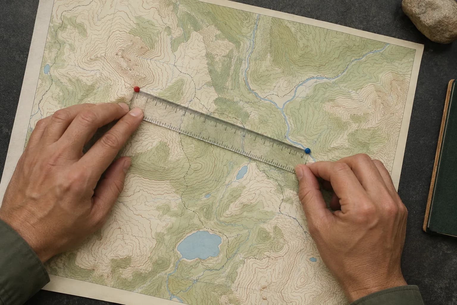
This guide uses one fictional topographic map to show the full method: interpret the ratio in matching units, convert centimetres to metres or kilometres, measure a curved path, work backwards from a known real distance, and test whether a copied or screen-shown map still has the intended physical scale. Every calculation can be done on paper. The photographs illustrate measuring techniques but are not numerical diagrams; use the figures printed in your own exercise for exact answers.
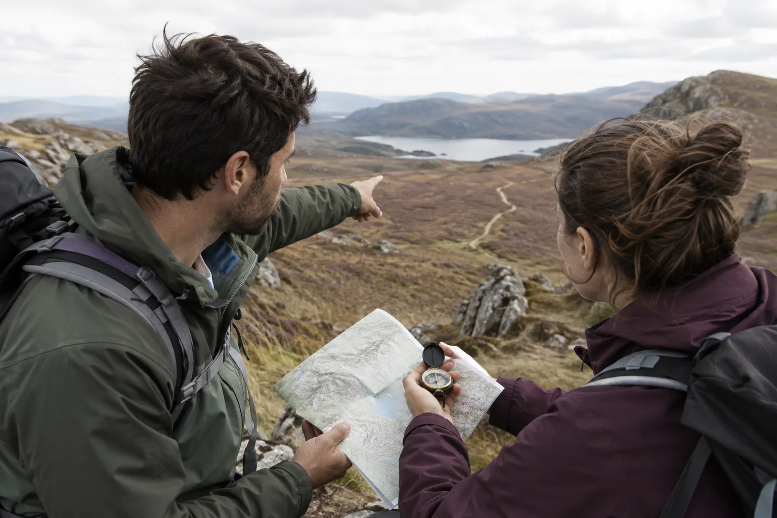
The U.S. Geological Survey describes a map scale such as 1:25,000 as a representative fraction: one unit on the map corresponds to 25,000 of the same units on the ground. The French mapping agency IGN gives the helpful metric interpretation, 1 cm to 250 m, for this ratio. Once the units match, the arithmetic is straightforward; the more interesting skill is deciding which physical length and which version of the map the ratio actually describes.
Read the ratio before you calculate distance on a map
A scale written 1:25,000 compares a length on the map with the corresponding horizontal ground length. It does not mean one centimetre equals 25,000 metres. The two sides of a numerical ratio use the same unit. Thus 1 cm on the intended-size map represents 25,000 cm in reality; 1 inch would represent 25,000 inches. For our metric example, convert 25,000 cm to 250 m by dividing by 100. Write '1 cm map = 250 m ground' beside the ratio before measuring anything else.
Check what the question calls distance. A ruler between two marks gives their straight-line separation on the sheet. A drawn road or walking trail bends, so its route length requires following the bends. Neither length is automatically the time needed to travel, and neither accounts for a steep climb unless the task supplies further information. The geometry-diagram guide explains why a picture alone cannot supply facts missing from its labels. The map's ratio is one such stated fact; a visually appealing curve is not a measurement by itself.
Convert 4.8 centimetres at 1:25,000
Suppose two points are exactly 4.8 cm apart on a correctly printed 1:25,000 map. Multiply without changing units midway: 4.8 cm × 25,000 = 120,000 cm. Then divide by 100 to get 1,200 m, and by 1,000 to get 1.2 km. Equivalently, use the interpretation 1 cm = 250 m: 4.8 × 250 m = 1,200 m. Both routes agree. If you calculate 120 km, you have likely treated centimetres as metres or moved the decimal point too far.
A quick proportionality check can catch that mistake. Four centimetres at this scale would mean 4 × 250 m = 1,000 m, or 1 km. Since 4.8 cm is slightly more than 4 cm, 1.2 km is sensible. The German state surveying office in Bavaria demonstrates the same conversion pattern with a 1:25,000 map. Keep intermediate units visible, especially when a worksheet mixes centimetres for the paper, metres for a route, and kilometres for the requested answer.
Trace a route rather than a straight shortcut
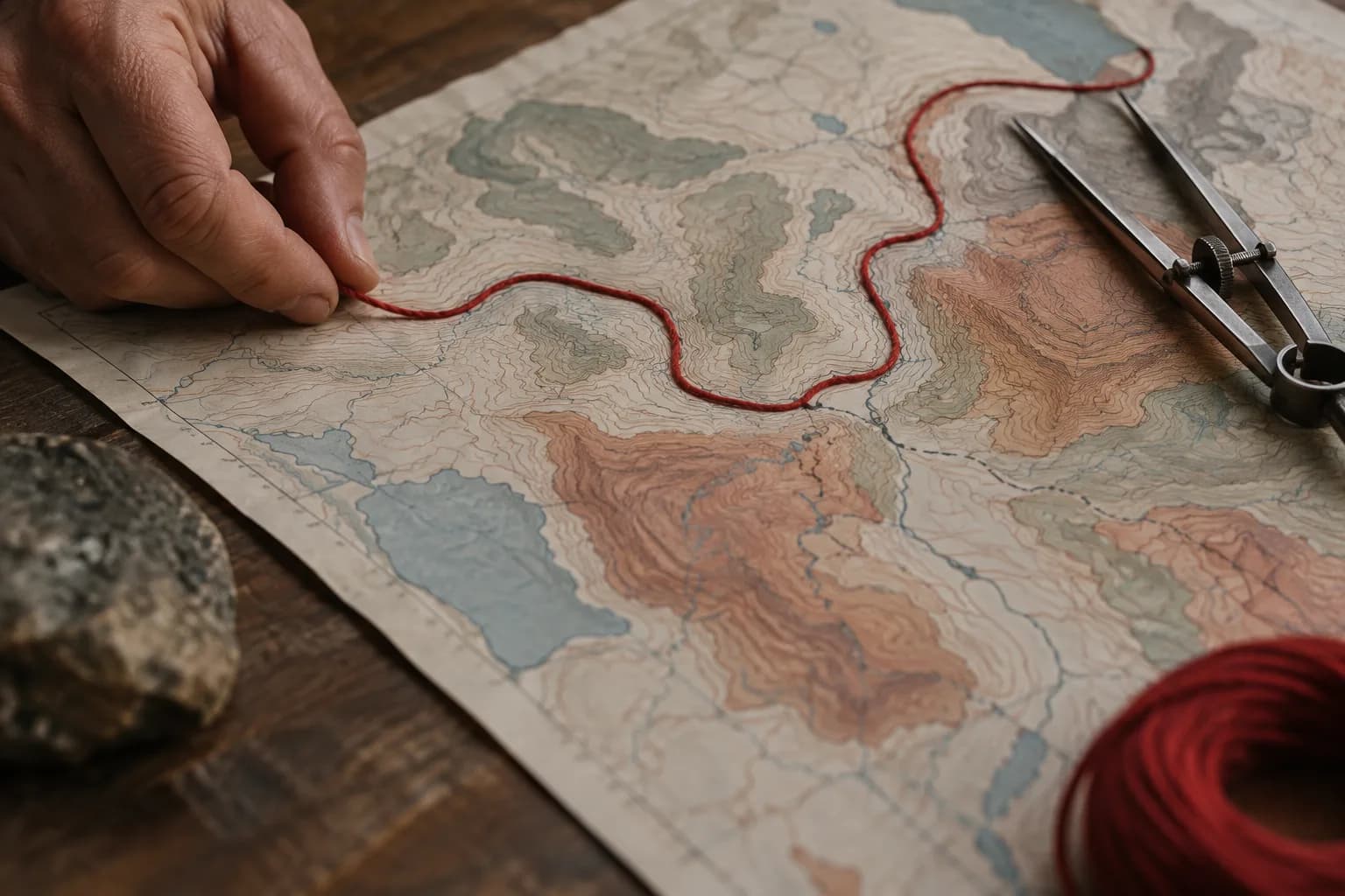
If the question asks for a trail, do not connect its start and finish with a straight ruler and call that the walking distance. Lay a thin thread along the drawn path, mark the start and end on the thread, straighten it, and measure the thread on a ruler. For a route of 6.4 cm on the same 1:25,000 paper map, the represented path length is 6.4 × 250 m = 1,600 m, or 1.6 km. The 4.8 cm straight connection represented 1.2 km, so the winding route is 0.4 km longer in this example.
You can also approximate a curve with short ruler segments. Add their map lengths before converting once, or convert each segment and add the ground lengths; consistent arithmetic gives the same total. The thread method is often easier for a smooth winding path, while segments suit routes with clear corners. Neither photograph is a calibrated map: measure the actual drawing in your exercise. If your map is schematic or the route line is thick, state the sensible precision rather than reporting an implausibly exact number of metres.
Work backwards from a real distance
Reverse problems ask how long a known ground distance should appear on the map. At 1:25,000, 750 m equals 75,000 cm. Divide by 25,000 and the map length is 3 cm. The shorter shortcut is 750 m ÷ 250 m per map centimetre = 3 cm. This is division, not multiplication, because the reduced drawing must have a much smaller number of centimetres than the real distance. Label the answer 'on the map' so it cannot be mistaken for a real-world length.
Sometimes the scale itself is unknown. If a correctly printed map shows a 1 km ground separation as 4 cm, first make units alike: 1 km = 100,000 cm. Divide actual length by drawing length, 100,000 / 4 = 25,000. The scale is 1:25,000. Check by multiplying 4 cm by 25,000 to recover 100,000 cm. The procedure is a proportional relationship, so our word-problem guide may help when an exercise gives the same information in a story rather than a neat ratio.
Use a scale bar when the map has been resized
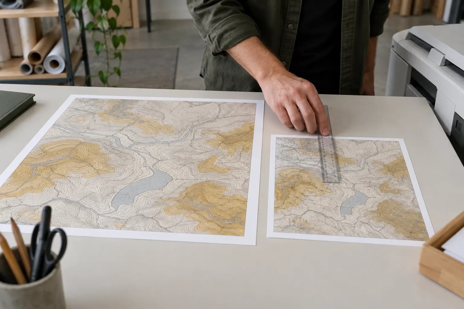
A printed 1:25,000 ratio describes the map at its specified physical size. If someone enlarges the page on a photocopier to 200%, the same ground feature measures twice as many centimetres on the new paper. Applying the old 25,000 multiplier to the enlarged measurement would double the answer. A screenshot on a phone can change physical size with zoom and screen settings, so a ruler held against the display is not automatically compatible with the ratio printed in its corner.
A graphic scale bar, when enlarged together with the map, can still be compared with a measured line on that same copy: the bar and route expand in the same proportion. Check that both are in the same image and that no part was cropped or stretched separately. IGN distinguishes the numeric ratio from a graphic scale bar and explains measuring a line against the bar. On a digital map, prefer its current measurement tool or dynamic scale rather than an old paper ratio, and verify what the tool measures.
Do not apply a length factor directly to an area
The map ratio multiplies lengths. If a rectangular region measures 2 cm by 3 cm on a 1:25,000 map, its represented ground sides are 500 m and 750 m. The area is 500 × 750 = 375,000 square metres, or 0.375 square kilometres. Multiplying the map area of 6 cm² by just 25,000 is wrong because the width and height are both scaled. If you choose the factor method, the area factor is 25,000 squared, with square units converted afterward.
This extension is useful for checking an answer's dimensions. A length answer should end in m or km; a surface answer ends in m² or km². The paper rectangle is a mathematical model, not a promise that a real irregular lake or forest is rectangular. For an irregular outline, you would need a suitable area-estimation method, and map symbols may exaggerate small features for visibility. State the geometric assumption before you multiply two represented sides.
Know what the map cannot promise
A scale conversion can give a defensible mapped distance, but it is not a navigation guarantee. A path may have switchbacks too fine to measure accurately, may be closed, or may change after the map was made. A topographic map shows relief with contours, yet the simple 1:25,000 multiplication describes horizontal representation, not the extra distance traveled while climbing a slope. IGN recommends choosing a suitable scale for the purpose: a detailed hiking map and a national road overview serve different questions.
A larger denominator such as 1:100,000 covers more ground per paper centimetre and generally shows less local detail than 1:25,000. The phrase 'large-scale map' can sound backward: it means a larger representative fraction and more detail, not a larger denominator. Read the printed legend rather than inferring precision from vivid colours or a smooth line. When a calculation informs a real outing, use current route information and account separately for terrain and conditions.
Check the arithmetic on a fresh map problem
Practise independently with a new scale. At 1:50,000, a 3.6 cm straight separation represents 3.6 × 50,000 = 180,000 cm = 1,800 m = 1.8 km. In the other direction, a real 2.5 km equals 250,000 cm, so it occupies 250,000 / 50,000 = 5 cm on a correctly sized map. A 5 cm curved line at that scale also corresponds to 2.5 km along the represented line, but it does not tell you the straight separation between its endpoints.
Check each answer in three ways: direction, unit, and reversal. The real length must be far larger than the paper length in matching units. Converting 180,000 cm by 100 and then 1,000 should yield 1.8 km; multiplying the reverse answer of 5 cm by 50,000 must recover 250,000 cm. Finally confirm that you measured the line the question actually names and that the sheet has not been resized. Our independent answer-checking guide offers further checks when no solution key is printed.
Put it into practice now
Choose one problem from your current homework or review set. Attempt it before opening Eqora, then use the app only at the point where your own reasoning stops.
- State what the problem is asking before you solve it
- Identify the first step you cannot justify
- Ask Eqora one focused follow-up about that step
- Finish with a similar problem and no solution in view
The session is complete when the method is clearer, not simply when the worksheet has one more answer.